NOAA Hurricane Hunters Get the Inside Scoop

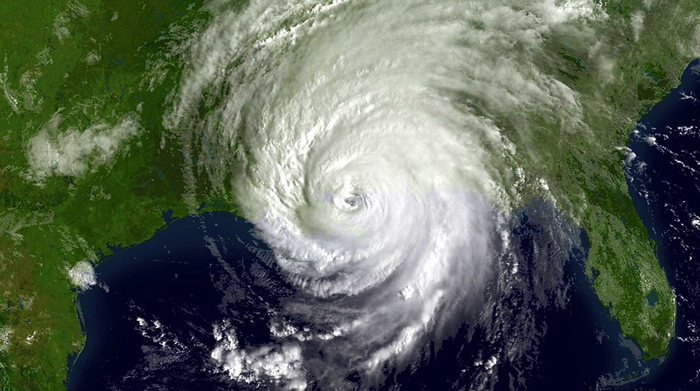
Image courtesy of NOAA Images under Public Domain Mark 1.0, resized to 700 x 391 pixels.
Data is the foundation of any forecasting activity, and when it comes to hurricanes, forecasts rely not only on computerized data from radar, satellites and data models, but also from hurricane hunters. These brave souls get hurricane information from the inside out, which is critical since any tiny deviation can invalidate a forecast.
How NOAA Utilizes Hurricane Hunters
NOAA’s hurricane hunters fly small airplanes equipped with specialized tools into the vicinity of the storms to get the inside track so to speak. One such tool is called “dropwindsonde,” which is a tube-shaped device that is dropped from the sky and takes readings on its way to the surface. These devices generally take about 4 minutes to reach the ground, and take readings on things such as storm pressure, temperature, wind speeds, wind direction and humidity levels.
Another tool these planes utilize is called a “bathythermograph,” which measures ocean temperatures and wind speeds at the ocean’s surface. They also have Doppler radar systems that take both vertical and horizontal measurements of the storm.
All told, NOAA has several varieties of aircraft in its fleet, each of which serves a different purpose. For example, some types of aircraft take internal measurements of the storm as described above, whereas others seek to predict landfall timing.
One thing they do have in common is that they are generally equipped with high-resolution cameras. Not only are these photos helpful for forecasting purposes, but they can also be used by local residents to visually see the extent of the damage in their neighborhoods.
In the final analysis, while hurricane hunters may not represent the primary means of obtaining data to forecast hurricane activity, they certainly represent a critical piece of the overall puzzle. By getting close-range images and measurements, the hurricane hunters provide NOAA with a means to see inside the storm for a more accurate view.


