How Satellites and Geospatial Analytics Can Reduce Power Outages
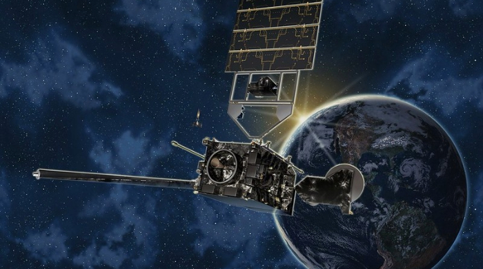
Image courtesy of NOAA Photo Library under Attribution 2.0 Generic Deed, resized to 700 x 391 pixels.
Satellites and geospatial analytics are being used by more and more electric utilities to proactively prevent outages. These technologies can essentially detect problems before they spiral into full blown emergencies. In other words, it’s the essence of emergency preparedness.
Why Satellites and Geospatial Analytics are the Wave of the Future
The bird’s-eye view that satellites provide is invaluable. Satellite technology can quickly identify vegetation threats, soil erosion, flooding, methane emissions, encroachments, and other unexpected changes to the terrain. The technology can scan thousands of miles of land in the blink of an eye, offering a level of visibility that is simply not possible with boots on the ground.
Commercial satellite operators like Airbus can help make usage of this technology a reality for utility companies. By partnering with this type of provider, it’s actually possible to capture images in precise detail, down to 30 centimeters. The collected data is then transmitted via the cloud to systems that utilize AI and machine learning to analyze the data. Eventually, comparing images and insights over time will start to reveal problematic issues in near real time. Alerts can also be triggered whenever an issue is detected that needs to be dealt with quickly.
Southern Company utilizes satellite imagery and geospatial analytics to monitor thousands of miles of transmission lines across Alabama, Georgia, Florida, and Mississippi, to great effect. Southern’s use case is focused on easement encroachment, as capturing issues in this regard quickly can help avoid tens of thousands of dollars in costs down the road. But again, there is much, much more than can be done to optimize usage of the technology.
In the final analysis, utilities should be turning over every rock to drive down the frequency of electricity interruptions. And utilization of satellites in conjunction with geospatial analytics is one such rock that utilities should be peeking under.